Mountain Map Vitosha 50/70
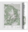
Vitosha – the symbol of Sofia, home to the majestic Cherni Vrah peak, offering a panoramic view over the capital.

Vitosha – the symbol of Sofia, home to the majestic Cherni Vrah peak, offering a panoramic view over the capital.
SKU: 9786199327906
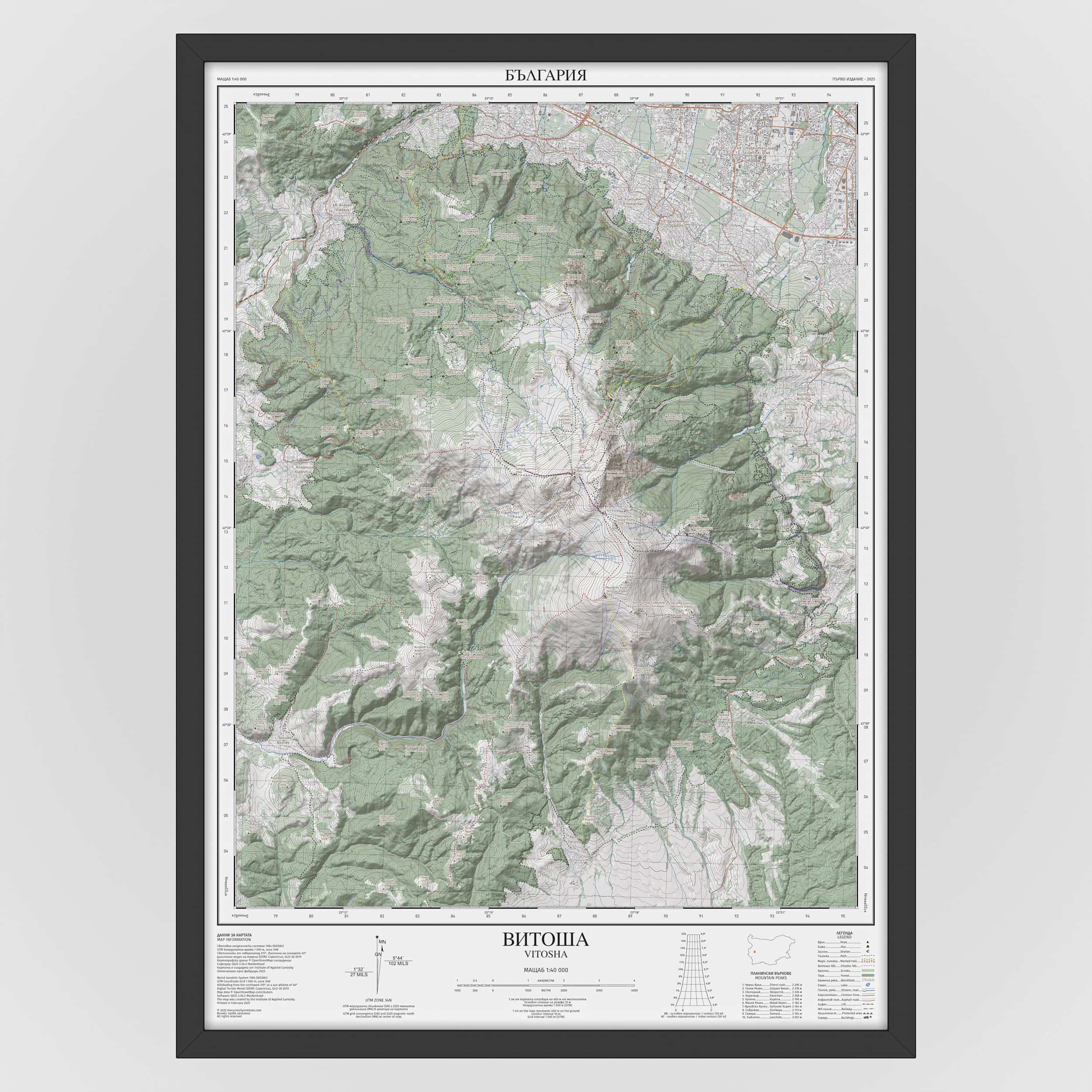
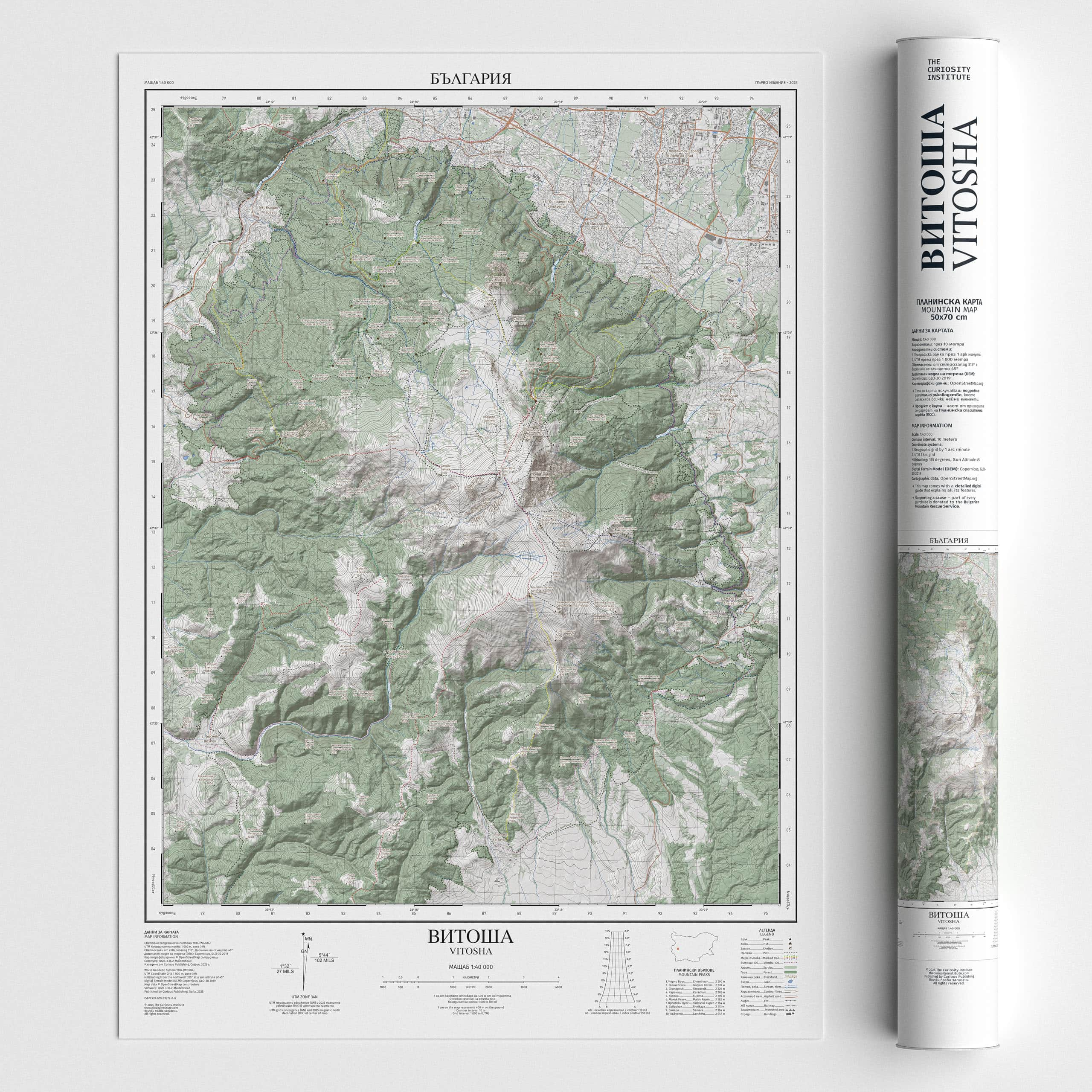
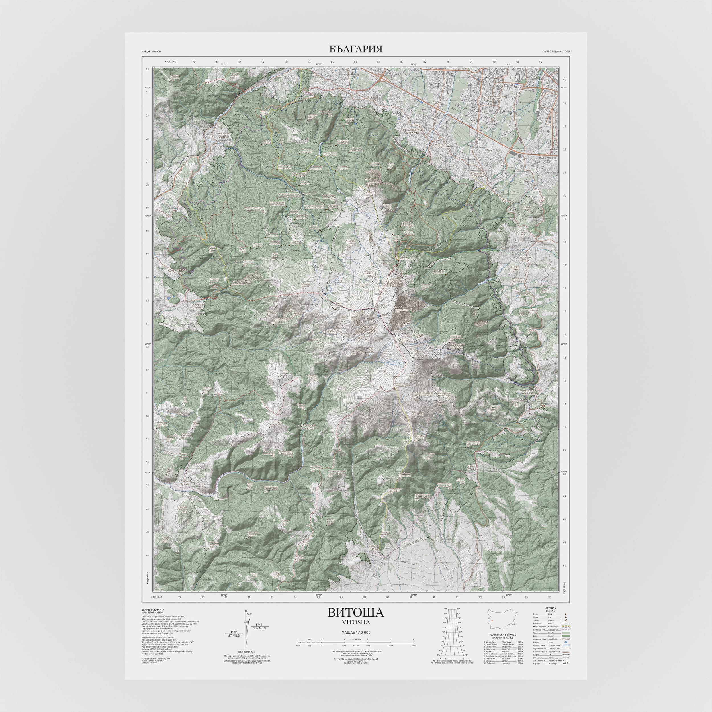
The map is at a 1:40,000 scale, where 1 cm on the map corresponds to 400 meters in reality. It features contour lines at 10-meter intervals, with shaded relief illuminated from 315° (northwest) at a 45° sun angle. Terrain, peaks, hiking trails, huts, shelters, lakes, and rivers are depicted in a way that enables quick orientation and a clear understanding of the landscape.
The map allows orientation using:
A geographic coordinate grid (latitude/longitude) with divisions every 1 arc minute, labeled every 3 minutes, with each minute subdivided into 12 arc seconds;
A Universal Transverse Mercator (UTM) grid with 1,000-meter spacing, superimposed on the terrain.
Additional elements include:
Legend;
List of the ten highest peaks;
Scale bar;
Slope diagram for calculating the average slope of a selected segment;
Diagram showing true north, magnetic declination and the deviation of the UTM grid from true north.
The map deliberately includes only carefully selected cartographic elements to achieve clarity and focus.
With every order, you’ll also receive a detailed digital guide to help you interpret every element of this map.
This product has a social mission – part of the proceeds are donated to the Bulgarian Mountain Rescue Service (MRS).
The poster is perfect as decoration or as a gift for mountain lovers, as well as enthusiasts of design and cartography.
The map comes with free shipping.
Size: 50 × 70 cm
Paper: 170 g matte
The frame (RODALM) is shown for illustrative purposes only.
- Цената на доставка е 5 лв. за цялата страна за 2 раб. дни.
- Доставките се извършват с куриерска фирма ЕКОНТ всеки работен ден.
- Доставката е безплатна за поръчки над 150 лева.
Имате правото да се откажате или да замените получената стока в 14 дневен срок при условие, че е в оригиналният си вид, запазен етикет и не са на лице следи от употреба.
Потребителят има право на рекламация при:
- констатирани липси
- дефекти на стоката
- несъответствие с обявения размер
- несъответствие с обявената търговска марка
При предявяване на рекламация потребителят може да претендира за:
- замяна на стоката с нова
- подмяна със сходен продукт
- възстановяване на заплатената сума
Descriere detaliata
The map is at a 1:40,000 scale, where 1 cm on the map corresponds to 400 meters in reality. It features contour lines at 10-meter intervals, with shaded relief illuminated from 315° (northwest) at a 45° sun angle. Terrain, peaks, hiking trails, huts, shelters, lakes, and rivers are depicted in a way that enables quick orientation and a clear understanding of the landscape.
The map allows orientation using:
A geographic coordinate grid (latitude/longitude) with divisions every 1 arc minute, labeled every 3 minutes, with each minute subdivided into 12 arc seconds;
A Universal Transverse Mercator (UTM) grid with 1,000-meter spacing, superimposed on the terrain.
Additional elements include:
Legend;
List of the ten highest peaks;
Scale bar;
Slope diagram for calculating the average slope of a selected segment;
Diagram showing true north, magnetic declination and the deviation of the UTM grid from true north.
The map deliberately includes only carefully selected cartographic elements to achieve clarity and focus.
With every order, you’ll also receive a detailed digital guide to help you interpret every element of this map.
This product has a social mission – part of the proceeds are donated to the Bulgarian Mountain Rescue Service (MRS).
The poster is perfect as decoration or as a gift for mountain lovers, as well as enthusiasts of design and cartography.
The map comes with free shipping.
Size: 50 × 70 cm
Paper: 170 g matte
The frame (RODALM) is shown for illustrative purposes only.